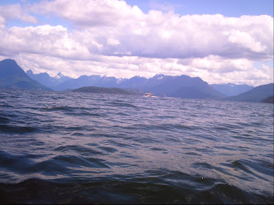
Crossing Desolation Sound with Kinghorn Island straight ahead.
The strong winds and a pain in my shoulder kept me up most of the night so I got off to a late start launching at 11am. The day started with beautiful clear skies and a wind out of the south that helped to push me along all day.
Crossing Desolation Sound was the only real obstacle on today’s paddle. The weather was cooperating though and the four-mile crossing went without a hitch. Kinghorn Island out in the middle of the sound did come in handy as a windbreak. As the wind was coming out of the south west at around 15mph I went around the south east side of the island and was able to stay in it’s wind shadow all the way to Redonda Island on the north side of the sound.

Refuge Cove
I stopped at Refuge Cove to check out the marina and fill my water bottles. The small store there did not have much in the way of supplies, and the water faucet at the dock had a sign indicating the water was not potable.

Heading up Lewis Channel north of Refuge Cove.
As I headed out of Refuge Cove into Lewis Channel, I got my first look at snow-covered peaks off in the distance. This was why I had come all this way to paddle and the scenery in front of me made it all worthwhile. The wind was still blowing, but now that I was in the confines of Lewis Channel, the waves were not as big a problem as they had been while crossing Desolation Sound. The clouds started to thicken, and the sky got darker, but the rain held off with not much more than a scattered drizzle. There were no good spots to camp along Lewis Channel as the shoreline consisted of boulders and shear rock all the way to the waterline. Above the rocks was an impenetrable wall of vegetation.

Lewis Channel
I continued paddling up Lewis Channel to it’s junction with Calm Channel, Deer Passage, and Sutil Channel. The Rendezvous Islands, my destination for this evening, were located right at the intersection of these channels. The southernmost of these three islands is a BC Marine Trail Park. There was supposed to be campsites at both the northern and southern ends of this island but after looking carefully, I could find neither. My only alternative now was to keep going and hope I would run into a suitable campsite soon. When I reached the north tip of the northern most Rendezvous Island, there at last, was a place to land with a level tent site above high tide. This campsite was interesting in that it was located on a tiny island connected to the largest of the Rendezvous Islands by a gravel beach. This beach is exposed at low tide and covered at high tide, cutting off access to the larger island.

Rendezvous Island appears off in the distance in Calm Channel.
After landing at 6pm I set up my tent, had something to eat, and fell asleep early. I had covered 24 miles today in seven hours.

My campsite at the north end of North Rendezvous Island.